


Route 15: De Marke Harpel
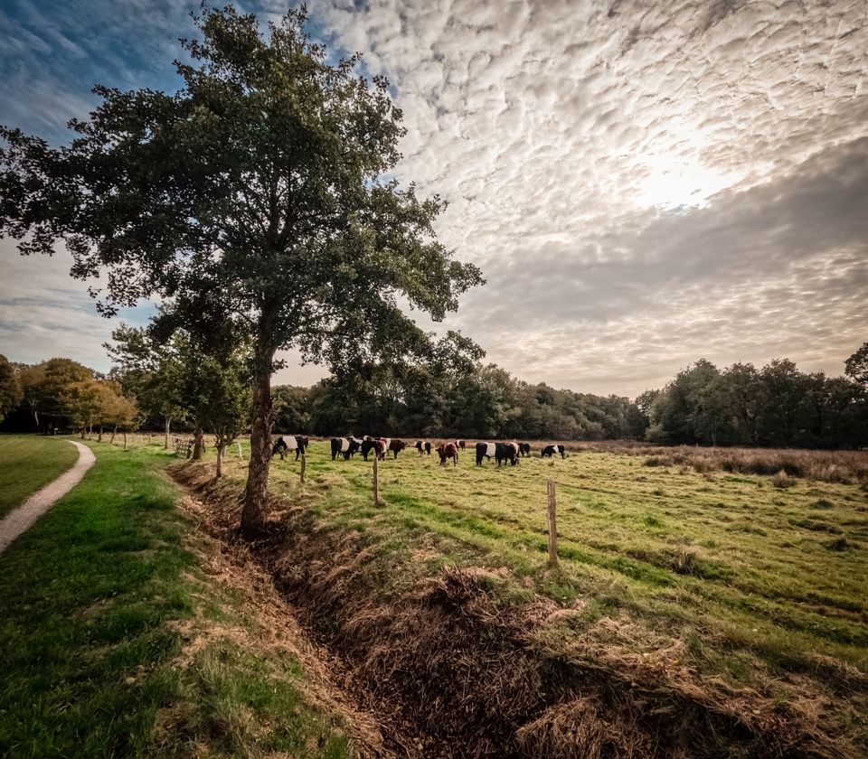
On this route you walk around Harpel and through part of the dal van de Ruiten Aa. The route is 13.3 kilometres long. Some sections along ditches are not always on level ground and can therefore be somewhat difficult to walk on (especially from point 32 onwards).
The Ruiten Aa stream valley and the adjacent woods and nature reserves form part of Natuurwerk Nederland. This is the backbone of nature conservation. Key nature reserves are linked together as much as possible. Sometimes this is achieved by bringing agricultural land under nature conservation management, and sometimes by creating ecological corridors, enabling animals (and often the plants alongside them) to move from one nature reserve to another. The Ruiten Aa stream valley is narrow in places, and the nature reserves border directly on intensively farmed land.
The walk, which starts in Harpel, runs past the Metbr…
The Ruiten Aa stream valley and the adjacent woods and nature reserves form part of Natuurwerk Nederland. This is the backbone of nature conservation. Key nature reserves are linked together as much as possible. Sometimes this is achieved by bringing agricultural land under nature conservation management, and sometimes by creating ecological corridors, enabling animals (and often the plants alongside them) to move from one nature reserve to another. The Ruiten Aa stream valley is narrow in places, and the nature reserves border directly on intensively farmed land.
The walk, which starts in Harpel, passes through the Metbroekbos near Smeerling and across the Ellersinghuizerveld, a large-scale agricultural area. For many years, this was a contentious area. Those involved in the major land-use planning project (the Redevelopment of East Groningen and the Groningen-Drenthe Peat Colonies) – the farmers and the nature conservationists – both laid claim to the area. The farmers wanted to farm the land, whilst the nature conservationists sought to incorporate it into the Natuurwerk Nederland scheme and use it as a buffer between agriculture and the natural environment in the stream valley. This valley contains valuable woodland areas (Liefstinghsbroek and Metbroekbos) and riparian zones. Natuurmonumenten has since restored the Ellersinghuizerveld area to its 1850 state. At that time, the area consisted of uncultivated land with an open, expansive character. Part of the nature reserve has been excavated, allowing heathland and nutrient-poor grassland to re-emerge. At the lowest point, part of the fen has been restored to its original state. This benefits plants such as sundew, pill fern and water primrose.
Comments or suggestions? Let us know via the contact form
This is a route of the Stichting Wandelen in Westerwolde and is sponsored by Huisartsenpraktijk Bouwman in Musselkanaal and by B&B de Hiddingh Hoeve, Smeerling 17, 9591 TX Onstwedde, bob.rossingh@outlook.com, tel. (+31)6 50650052.
Here’s what you’ll see
-
Starting point:
Community centre 'Ons Buurthoes
Harpelerweg 37
9541 TT Vlagtwedde
Navigate to the starting point
Features
Tour/Route
- Route typing: Nature trail
- Route features: From A to A
- Tagged: Yes
Walking
- Dogs must be kept on a lead Yes