


Route 2: De Gaast Wedde
On this route, you’ll walk through the Gaast nature reserve. This route is 3.5 kilometres long.
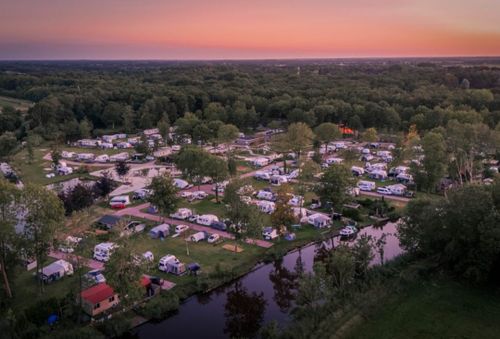
From Wedde and the De Wedderbergen recreation area, you can enjoy four lovely, short walks through the floodplains of the Westerwoldse Aa. The village itself, which together with Wedderveer has a population of around 1,200, is also well worth a visit, if only for the Wedderburcht on the outskirts of the village.
De Gaast is a protected nature reserve that used to form part of the Westerwoldse Aa, but was later filled in. This nature reserve is now used as an overflow area, acting as a water buffer, when the water level in the Westerwoldse Aa becomes too high. To this end, concrete steps have been built into the embankment at several points along the Westerwoldse Aa, over which the water from the river then flows. In such cases, the route may not be accessible.
On this walk, you’ll come across…
From Wedde and the De Wedderbergen recreation area, you can enjoy four lovely, short walks through the floodplains of the Westerwoldse Aa. The village itself, which together with Wedderveer has a population of around 1,200, is also well worth a visit, if only for the Wedderburcht on the outskirts of the village.
De Gaast is a protected nature reserve that used to form part of the Westerwoldse Aa, but was later filled in. This nature reserve is now used as an overflow area, acting as a water buffer, when the water level in the Westerwoldse Aa becomes too high. To this end, concrete steps have been built into the embankment at several points along the Westerwoldse Aa, over which the water from the river then flows. In such cases, the route may not be accessible.
On this walk, you will pass the Kompen kolk (point 5), created as a result of a dike breach, probably due to the storm/flood of 12-13 November 1686. There were very many dike breaches on that night. Only this kolk has been preserved; the other kolks have been filled in over the years
This is a route of the Walking in Westerwolde Foundation, sponsored by Camping Wedderbergen.
Comments or remarks? Let us know via the contact form.
Here’s what you’ll see
-
Starting point:
Parking area Camping Wedderbergen
Molenweg 2
9698 XV Wedde
Navigate to the starting point

Features
Walking
- Dogs must be kept on a lead Yes
Tour/Route
- Tagged: Yes
- Explanatory marking: Yellow - white marked WIW 2
- Route typing: Nature trail
- Route features: From A to A
- Explanatory season: Please note that the bank path along the Westerwoldse Aa can sometimes be very boggy and difficult to access at high tide, especially in autumn and winter. Wearing waterproof footwear is therefore recommended.