
Route 17: Soldiers' dike Bourtange
On this route, you walk right through the Bourtangerveen and across the Soldiers' Dike. This route is 6 kilometres long.
The Bourtanger moor was a natural border between Groningen and Ost-Friesland. The passable routes through the moor were on pincers or sand ridges. In case of discord with neighbours, such a route was easy to close off. The bishop of Münster, Bommen Berend, knew that. Old field names (Munsterse kampen) still remind us of his siege.
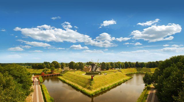
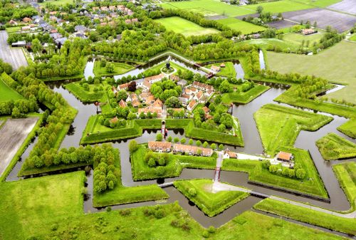
The star-shaped defence work Bourtange is a work of art in itself. Beauty and functionality also went well together in the military field. In 1971, the complete reconstruction of de fort, which had been decommissioned a century and a half ago, began. Thus, we can now enjoy a special landscape with many historical elements.
The gallows on Nieuwwerksweg recalls...
The Bourtanger moor was a natural border between Groningen and Ost-Friesland. The passable routes through the moor were on pincers or sand ridges. In case of discord with neighbours, such a route was easy to close off. The bishop of Münster, Bommen Berend, knew that. Old field names (Munsterse kampen) still remind us of his siege.
The star-shaped defence work Bourtange is a work of art in itself. Beauty and functionality also went well together in the military field. In 1971, the complete reconstruction of de fort, which had been decommissioned a century and a half ago, began. Thus, we can now enjoy a special landscape with many historical elements.
The gallows on Nieuwwerksweg recalls a different view of guilt and penance. East Groningen still has a number of old gallows fields or humps, surrounded by stories of witchcraft, torture and execution. People were very prone to superstition in those days. So the story goes that the house that stood at the end of the 1st Pallertweg was bewitched. The children there were always sick. And yes, one found a witch's wreath on one of the bed pillows...
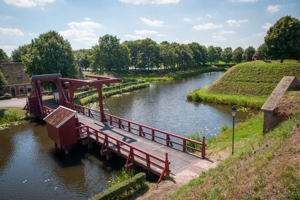
The walking route runs through the de vestings forecourt, an area that could be flooded if there was a threat from the east. Locks and dykes were used to create an additional line of defence when the swamp lost its impenetrability due to drying out.
The Soldiers' Dyke (point 14), for example, was built at the time to prevent water leaking to the lower north. At the end of this dyke is a small sluice to regulate the water level. This lock was of such strategic importance that a small field entrenchment (Redoute Bakoven) was built to secure it. In times of danger, Bourtange lay like an island in shallow water. Work has now begun to restore this 'wet horizon'.
The Groninger Landscape Foundation now manages this area. The management organisation organises excursions in this area. Rare plants such as gale, Zwolse carnation, paintbrush and mouse-ear grow along Soldatendijkje.
Comment? Let us know via the contact form
This is a route of the Walking in Westerwolde Foundation, sponsored by Eetcafe 't Oal Kroegie - Bourtange.
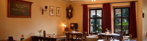
At the Marktplein you will find 't Oal Kroegie, an atmospheric café where you can enjoy a cup of coffee or tea at your leisure. You are also welcome here for lunch or a drink. There is a separate room for small parties.
You are going to see this
Starting point:
Informatiecentrum Vesting BourtangeWillem Lodewijkstraat 33
9545 PA Bourtange
Navigate to starting point
Starting point
Information centre Fort Bourtange
Willem Lodewijkstraat 33
9545 PA Bourtange
Navigate to starting point
End point:
Informatiecentrum Vesting BourtangeWillem Lodewijkstraat 33
9545 PA Bourtange
Navigate to end point
Features
Tour/Route
- Tagged: Yes
- Explanatory marking: Yellow - white marked WIW 17
- Route typing: Nature trail
Walking
- Dogs on a leash Yes